Distinguishing between plant canopy and soil
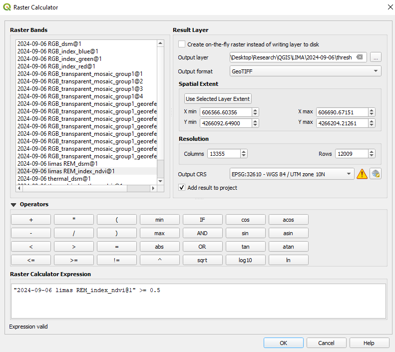
Want to calculate the canopy area of your plots? Want to eliminate soil pixels from a data set? To do these things, we will need to come up with a threshold for NDVI, ExG, or whichever vegetation index you have used in the previous steps. Above this threshold value, we will consider everything to be living plant canopy. Soil, dead plant residue, and most other materials will be below it. We will use the Raster Calculator for doing this as well.
- Reopen the raster calculator, Raster → Raster Calculator.
- As done previously, click the three dots to the right of “output layer” to give a name and directory to the new file you will create.
- In the Raster Calculator Expression box, enter an expression by clicking on your layer names and typing symbols as follows:
(Your vegetation index file name) >= threshold value
(0.5 works well for NDVI, use other numbers for other VIs)
- The value of the threshold may need to be adjusted for different vegetation indices, and at times for lighting, camera settings, etc.
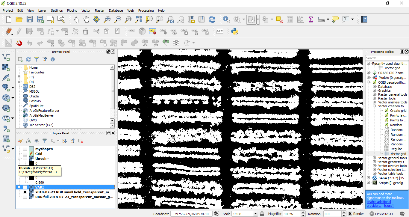
- Check that your threshold accurately distinguishes plant and soil, rather than over- or under-estimating these:
- Find the “Layers Panel” at the bottom left.
- Uncheck any files other than your RGB orthomosaic and the new threshold file.
- Check and uncheck the new threshold file to make sure there is good correspondence between the highlighted area in your threshold file and the original orthomosaic. It should look something like this:
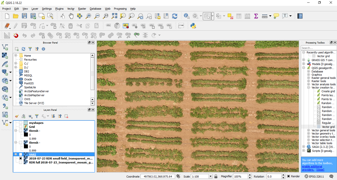
- If your threshold file underestimates canopy area, repeat steps 1-5 with a lower value for the threshold. If a lot of soil or other material is counted as canopy, then increase the threshold value.