How to align maps using the Georeferencer in QGIS
Note: This is useful for lining up maps from different flight days or different sensors so a single plot grid can extract all the data, or so comparisons can be made between them. For example, you could use an NDVI-based plant/soil classification layer to remove soil pixels from a thermal camera. But it is optional and depends on your needs!
See also: https://docs.qgis.org/3.40/en/docs/user_manual/working_with_raster/georeferencer.html
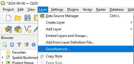
- Layer → Georeferencer
- In the new window: File → Open Raster.
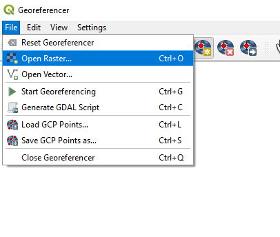
- Open the tif file of interest (to be corrected).
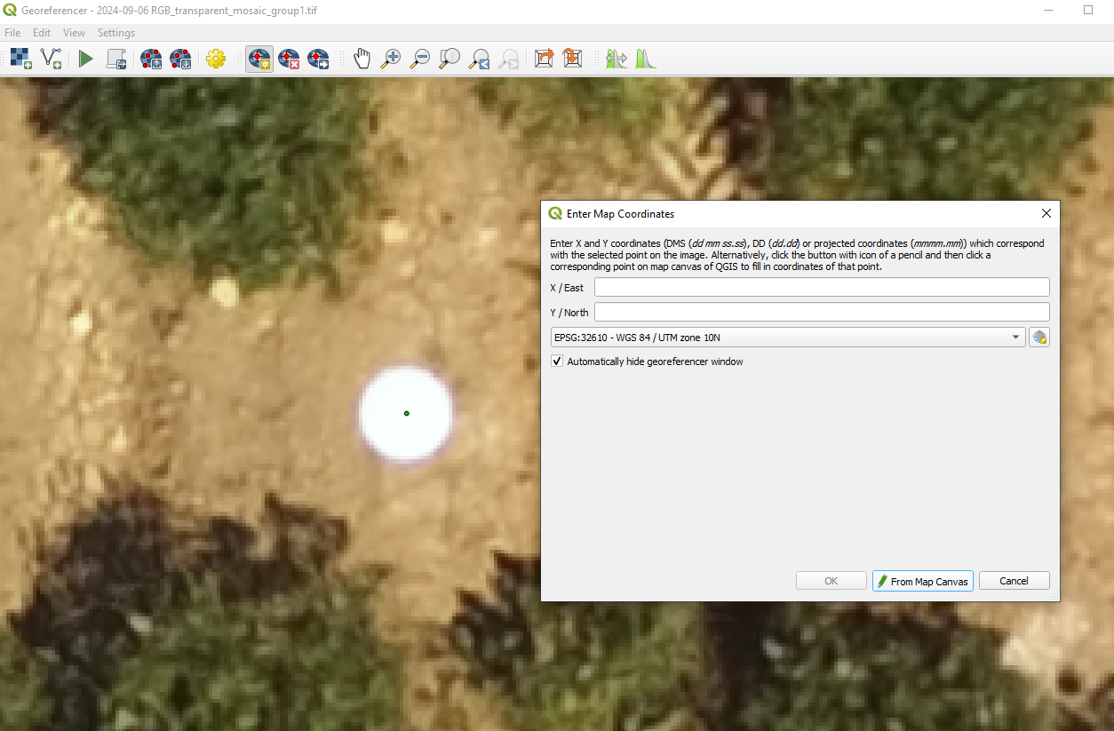
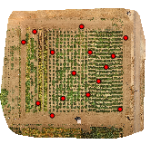
- Click a point that can be compared between maps, and in new window that pops up, click “from Map Canvas”. Then select the corresponding point in the other map, and click “OK”
- Repeat the step above for 10-15 points.
- Click Settings → Transformation settings:
- For transformation type, click the drop-down and select “Thin plate spline” (I don’t recommend “linear”, which will only move+rotate+expand/contract the raster, not correct spatial distortions!)
- For resampling method, click “Cubic”
- Next to output folder, click the three dots to select a folder and file name
- At the bottom, ensure that the box for “Load into project when done” is checked.
- Click “OK”
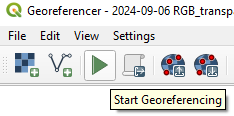
- Click the green play button (“start georeferencing”).
- Check the new layer ensure it aligns with your other files!